
Category:Maps of Japan
Wikimedia category | |||||
| Upload media | |||||
| Instance of | |||||
|---|---|---|---|---|---|
| Category combines topics | |||||
 | |||||
Maps of Japan.
Subcategories
This category has the following 28 subcategories, out of 28 total.
Pages in category "Maps of Japan"
The following 4 pages are in this category, out of 4 total.
Media in category "Maps of Japan"
The following 47 files are in this category, out of 47 total.
-
 1830 map gokaido.jpg 770 × 550; 262 KB
-
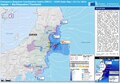
 2021-12-3 海水温.png 585 × 512; 186 KB
-
 Early Jōmon migrations.jpg 526 × 619; 54 KB
-
 ECDM 20140303 World Events.pdf 1,625 × 1,125; 645 KB
-
 ECDM 20140710 World Events.pdf 1,625 × 1,125; 527 KB
-
 ECDM 20140806 World Events.pdf 1,625 × 1,125; 424 KB
-
 ECDM 20160415 EQ Event.pdf 1,625 × 1,125; 771 KB
-
 ECDM 20161122 Japan-EQ.pdf 1,625 × 1,125; 778 KB
-
.png/120px-Ecoregions_du_JAPON_(WWF).png) Ecoregions du JAPON (WWF).png 2,480 × 3,507; 5.94 MB
Ecoregions du JAPON (WWF).png 2,480 × 3,507; 5.94 MB
-
 EU security pacts.svg 2,754 × 1,398; 1.12 MB
-
 Japan stub2.png 70 × 90; 2 KB
-
 Japan Super Rugby franchise region.png 1,635 × 1,751; 154 KB
-
 Japan test map1.jpg 8,271 × 11,698; 4.73 MB
-
 Japankorea.jpg 2,081 × 1,606; 921 KB
-
 Japanll.jpg 800 × 600; 154 KB
-
 Japanlr.jpg 800 × 600; 124 KB
-
 Japanul.jpg 800 × 600; 132 KB
-
 Japanur.jpg 800 × 600; 151 KB
-
 Japonia in Asia map.png 1,188 × 1,439; 376 KB
-
 Kadena and Yomitan, January to December 1945.png 2,418 × 1,144; 2.62 MB
-
 Kurhetfigq34brt67g.png 32,765 × 32,650; 12.33 MB
-
 Map of Super GT.png 320 × 370; 12 KB
-
 Map-japan-10201.jpg 1,523 × 1,523; 185 KB
-
 ME-deposits.gif 882 × 808; 732 KB
-
.png/120px-Megabalaena_(type_locality).png) Megabalaena (type locality).png 1,939 × 1,014; 1.19 MB
Megabalaena (type locality).png 1,939 × 1,014; 1.19 MB
-
.jpg/120px-Newly_enlarged_itinerary_map_of_Japan_(14498491989).jpg) Newly enlarged itinerary map of Japan (14498491989).jpg 5,000 × 213; 1.53 MB
Newly enlarged itinerary map of Japan (14498491989).jpg 5,000 × 213; 1.53 MB
-
 Nihon sozu - RLPX 6= 7.jpg 2,770 × 1,976; 1.05 MB
-
 Northern Japan Map.png 151 × 171; 30 KB
-
 NTT National Shigai Kyokuban introduction.jpg 1,371 × 1,330; 514 KB
-
 Ogasawara Subprefecture in Tokyo Metropolis.png 950 × 701; 112 KB
-
.jpg/120px-Panoramic_view_of_the_noted_places_of_Tōkaidō_Highway_(14744637042).jpg) Panoramic view of the noted places of Tōkaidō Highway (14744637042).jpg 2,500 × 1,884; 2.57 MB
Panoramic view of the noted places of Tōkaidō Highway (14744637042).jpg 2,500 × 1,884; 2.57 MB
-
.jpg/120px-Panoramic_view_of_the_scenic_spots_of_sea_and_land_of_Shimōsa%2C_Kazusa_and_Awa_Provinces_(14558252830).jpg)
-
 PAT - Japan and Korea.gif 1,730 × 1,800; 617 KB
-
 Ryūkyū-Königreiche in der Sanzan-Zeit.jpg 550 × 741; 87 KB
-
 Shinkansen map 202405 en.png 3,100 × 3,200; 1,002 KB
-
 Shinkansen map 202405 ja.png 3,100 × 3,200; 753 KB
-
 Silence-Geography.png 425 × 322; 61 KB
-
.png/120px-Target_map_-_Minami_Daito_Jima_(1944).png) Target map - Minami Daito Jima (1944).png 1,446 × 1,815; 968 KB
Target map - Minami Daito Jima (1944).png 1,446 × 1,815; 968 KB
-
.jpg/120px-The_office_of_the_father_of_Mei_and_Satsuki_(40802183114).jpg) The office of the father of Mei and Satsuki (40802183114).jpg 3,456 × 2,304; 3.18 MB
The office of the father of Mei and Satsuki (40802183114).jpg 3,456 × 2,304; 3.18 MB
-
 Txu-pclmaps-oclc-22834566 h-12c.jpg 9,190 × 6,725; 9.82 MB
-
 Typhoon Judy 1989.jpg 192 × 141; 9 KB
-
.jpg/120px-Visualized_itinerary_of_Great_Japan_(15129455592).jpg) Visualized itinerary of Great Japan (15129455592).jpg 6,000 × 967; 3.63 MB
Visualized itinerary of Great Japan (15129455592).jpg 6,000 × 967; 3.63 MB
-
 Нампо.gif 544 × 705; 12 KB
-
 【無害化済み】map-japan-10201.png 1,523 × 1,523; 195 KB
-
 東春日井郡史尾張古図.jpg 1,209 × 1,703; 280 KB
-
 無題87 20230317171858.png 1,809 × 2,048; 276 KB
-
 都道府県コード.png 1,102 × 767; 258 KB


.png)


.png)


.jpg)


.png)
.jpg)


.jpg)
.jpg)
.jpg)